Data and decisions for Nature Based Solutions (NbS) are under greater scrutiny than ever before. Ready access to geospatial data and tools is vital to assess, verify, and report on natural assets with confidence and full transparency.
See how Earth Blox is used in NbS projects
In this video we demonstrate how the philanthropic foundation ADMCF uses Earth Blox to select and assess Nature Based Solutions (NbS) projects and monitor their performance as they work to address environmental and social challenges across Asia.
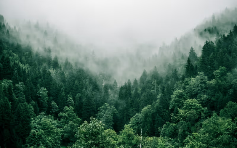
We walk through how to do land classification using Earth Blox. Looking at Borneo in Indonesia, we combine Landsat and radar data from the Google Earth Engine data catalogue, optimise to remove cloud cover, and select a colour palette to visualise the different land cover.
Our customers use Earth Blox to:
- Build and run analyses on over 900+ geospatial datasets in minutes
- Give project managers, commercial and on-the-ground teams a tool to DIY their analysis
- Automate repetitive analyses, freeing up time for their GIS analysts
For Ashley Bang, Head Data Scientist at ADM Capital Foundation, Earth Blox provides flexibility, agency and helps to control costs. Here's what she says:
“Increasingly, we see that the analytical tools and metrics needed by financial institutions to evaluate climate- and nature-related risks involve satellite imagery processing. Earth Blox has allowed us to shift remote sensing and satellite imagery processing capabilities in-house, providing greater flexibility, agency, and cost-effectiveness. In what is currently a pivotal point for the climate-biodiversity-finance nexus, this platform provides a valuable opportunity for our team to deepen our geospatial analytical capabilities without prior technical expertise or intensive training.”
Like to learn how you could use Earth Blox to manage your Nature Based Solutions project assessments and monitoring? Book an onboarding call now.
Video Transcript
All right, everybody. So what I'm going to do now is basically dive into use case. And I think there's no better way to demonstrate the usefulness and the simplicity of Earth Blox than just to dive into what it does. So, Ashley, Ashley is actually one of her users, she works for ADM Capital Foundation, which is a philanthropic foundation that invests heavily in projects around Southeast Asia. They are interested in funding projects where you have a confluence of different interests, interests that actually merge together. So you have high commodity production, so palm oil plantation, for instance, or it could be other commodities, where you find, you know, perhaps a concentration of livelihood that needs to be supported villagers and local population, but also where you have a really high concentration of endemic species and species that are requiring some some some investment to sort of support and for conservation. So she's really looking at very specific kind of projects to support. And how she does that is by looking at various kinds of datasets.
Before Earth Blox she would have to sort of hire consultants to do this. So there's a really long time lag between the time that she wants to make a decision and decide, okay, we're investing in this now. And the time that she actually gets the answer where, where they actually put their finances.
So next slide, please. So let's have a look at how she would go about interacting with Earth Blox the tool. So as a first user, she would come on to our platform, and she would be welcomed, you know, like knocking on the door, you come to a new tool, you want to know how it works. So she would be introduced with a small video that just basically shows, gets her running quickly. So how does Earth Blox work? What are the various functionalities that are essential for the initial onboarding? Next slide, please. Then we give an option to those data analysts that may not be familiar with or the observation or remote sensing in general, to sort of pick and choose something that resembles what they want to do. So whether that's, you know, looking at mangroves, or looking at deforestation or looking at potentially degradation instead of deforestation or flooding. So you can pick and choose an area of interest or focus, and then dive into this straight from the go.
Next slide, please. If you're an advanced user, or someone that actually has played with Earth observation before, then you can go straight into the platform. And here, what I'm going to do is just walk you through the sort of the, the jargon or the sort of the way the tool works. So when we talk about a workflow here, throughout my presentation, and in the future, if you end up using Earth Blox, a workflow is an assemblage, a collection of blocks, it's an analysis, if you will, so and in Earth Blox the way that we work, it's a bit like Lego. So you assemble blocks together, that creates an analysis, and then you press run, and you have your output. So a workflow is really that collection that we can see here in the big blocks.
Next slide, please. So on the left hand side is where you find all the blocks, you have three kinds of three categories of blocks, you have the blue blocks, which are all the input blocks, and the boundaries of your analysis. So in the blue blocks, you can select to work with, with imagery that is optical imagery, or you can select to work with already existing land cover classes, or you can select to work with fire detection datasets, a huge variety of datasets that are at your fingertips. That's also where you decide to work on a specific area, you may select to work in California, or Southeast Asia or in Malaga, if you want, right? So that's where you define the boundaries of where spatially and temporally you're working. So you can work, you know, over a 40 year period, or you can work on data that was collected last week.
The yellow blocks are where you find your analysis. What is it you want to do with that set? Do you want to look at the time? You know, historically how things have changed over time over the past 40 years? Do you want to look at just a point in time. So you sort of look at you know, the various analysis? Do you want to classify the land? Do you want to look at change detection? See? Or do you want alerts? So the analysis or the yellow blocks? And then ultimately, at last, you have the output? What do you want to see? Do you want to visualise this as a map? Or do you want everything tabulated in graphs and as a dashboard, that's where you can select how this is. This is then produced for you.
Next slide, please. That's just an example. Once you've played press play, here what I selected is the entire of the UK and I wanted elevation data. So that's a very simple example just to showcase how basically, a simple workflow can generate an output very quickly. Next slide, please. Now we're going to dive into the case study. Right. So Ashley is interested in Southeast Asia. Because they're one of our customers, I'm not going to talk about specifically her case study. So we're looking at an area which is similar in practice, but not exactly the area that she's focusing on. So what we're seeing now is she wants to identify areas where you find small holder, palm oil plantation, or industrial palm oil plantation, combined with villages, primary tropical forests, and potentially agriculture as well. So we're going to classify using various data set, we're going to classify the land so that she can rapidly identify where she can find these areas, these pockets where you have that confluence of different interest.
Next slide, please. So, here, what I'm doing is I'm looking at Borneo in Indonesia. And I can either select a shapefile. Or I could use a drop down menu where you have all the regions of the world or draw a polygon. And I'm inserting a new dataset. Here, you can choose anything from a wide range of datasets, including the Google Earth Engine catalogue. Here, we're looking at Landsat, we're integrating the entire Landsat catalogue. And I'm focusing on the area that you can see here in the green. In this case, here, I'm going to be looking at two years, I'm going to look at selecting all the imagery within the Landsat catalogue that covers the year 2021, and 2020. And that's because it's in many places in the world, it's a very cloudy environment. So we want to make sure we have enough of pixels or parts of the imagery that are not covered by clouds. Here, I'm basically going to bin all the parts of the images within that collection that I've selected that have a cloud cover more than 70%.
And now when I create a composite, I'm going to create a summary image, something that basically brings all the good pixels, from all that two year period that has a very, very low cloud cover, so that I have the equivalent of a summary image. And I'm going to save this dataset. So I've created if you will, an optimum data set from that two year period. And I've saved this. And because I work as part of a team, I'm going to write my comments here, I'm explaining to the team what I've done here. I'm tidying up a little bit in my workflow.
Here, we're going to integrate radar data. Radar data is really powerful, because it allows you to work with structural information on the land. And here I'm looking at one year only because radar is not affected by cloud cover. So I'm going to create here again, composite image that brings all the information that I now have over a year, it gives me a lot of information about the structure and how it changes in the seasonality. And I'm saving this data set again.
And I'm saving those two datasets, because I'm going to use this in my classification, just so that I can with as much accuracy as possible, identify and differentiate different line classes that exist in this area. Now, that's the yellow block. In this case, here I'm looking at classification. With you can see you can select various algorithm, but in this case, we're leaving it to random forest, it's quite one way machine learning that will help classify the various land. And I integrate the two datasets that I created earlier on. I have training data that I'm uploading there, and then I'm bringing my outputs. In this case here, I want to start visualising this, I want to see well, what is my classification, can I identify the villages and the areas where we have a confluence of different interests.
I chose a palette here that allows really to visually differentiate between the different land classes. I'm basically tidying up here my workflow, I am quite a tidy person. So I quite like when things are not looking too messy. So I mean, this is a workflow that if you have to code this and do this from scratch and downloading the images could potentially take a few days, right. And we've done this in a few minutes.
And that's the power of Earth Blox really is being able to see and visualise and conduct analysis and prototyping things in minutes rather than potentially weeks if or months if you don't know how to code. So what we have here is the dark green and the teal are the plantation areas. And the sort of lighter green is the more sort of natural forest the yellow area and the orange are agricultural fields and the villages and are what I call more urban villages and in the dashboard you have the confusion matrices, this sort of accuracy and all these things.
That's going to start again, so yes, we can move on to the next slide. So, of course, this went very fast. I mean, this is a webinar. So we have to try to show you as much as possible. We're very excited about Earth Blox, obviously. And I think the idea and the philosophy here is that we want you to be in the driving seat. It's not for us to run the analysis for you. Because as in the case with Ashley, for instance, she was interested in, in identifying those various areas that have a confluence of of interest, but there's a lot more she wants to do. She wants to identify those areas and those villages that have access to electricity or not, right, so she can really optimise the kind of the impact of our financial investment, right, making sure she supports those communities that really need it.
She also wants to look at change detection. Where are the areas where over the course of the past five years have experienced extreme deforestation? Can we support that? You know, not the deforestation, obviously. But can we support you know, the communities just to stop or halt? Halt that deforestation? Can we look at historically, what have the half the patterns been over the past 20 years in this area? Are there things that we can identify as being you know, early, you know, easy hanging fruit that we can address quite quickly. So that's what the time series.
So ultimately, that's what Earth Blox is for, is to give you the power to do your analyses how and when you want them. Next slide, please. This is just a quote from her, saying that, for her, it's been quite pivotal to start working with Earth Blox because she can do the analyses how and when she wants. It's a bit like expanding her team. So it's not a huge team at the moment, you know, so she can do a lot more than if she was relying on consultants and or having to sort of expand her team. There's a lot that she can do on her own or that a non EO expert can do within her team.
.png)

.png)